 Despite the weather forecasts of doom and gloom we had a pretty good paddle weekend on The Flowage, as those of us who grew up in the area refer to it. The Chippewa Flowage or 'Big Chip' is an impoundment of the Chippewa River that was created when NSP (now Excel Energy) built the Winter dam in 1924. Only about 7% of the 233 miles of shoreline has any sort of development and there are 140 islands, many of which have first come first serve campsites. The lake is known for muskie fishing and at least one world record has come out of its waters. For that reason it has been a prime fishing lake since well before I was born. Normally the lake is dotted with fishing boats but the fishing opener is not until next weekend and that's why the GurneyGranny suggested that this would be the perfect weekend to hit the Flowage.
I have been coming up to the area since shortly after I was born because my great aunt and uncle had a cottage on the lake. We all met on Friday night for the mandatory Wisconsin fish fry. Even though Pope Paul VI said it was OK not to eat fish on Fridays back in 1966, Wisconsinites have not quite embraced that yet and Friday fish is still a tradition. Our fish venue was the venerable Herman's Landing (now called simply 'The Landing') in the middle of The Flowage. It has been owned and operated by the Lac Court Orielles band of Lake Superior Chippewa Indians (official BIA designation) and has had a checkered history since they acquired it in 1999 but things are going well now. I looked at the 1954 big musky chart on the wall and noticed the name of one of my dad's cronies, Al Scott, a bar owner from my home town of Eau Claire. Who knows, the old man might have been on that trip and Al caught the only legal fish. GG had booked us in a 3 bedroom cabin at the R&R Bayview resort, correctly assuming that weather and arrival times might not accommodate paddling out to an island and setting up on a Friday night. The subsequent downpour and hail made us all happy that she did.
Saturday morning arrived with some drizzle but it quickly turned partly cloudy and a became a beautiful paddle day. I did not see a single boat the whole weekend, an unheard of situation during the fishing season. Wildlife, especially birds and waterfowl, were all over the place. None of the deciduous trees even had any buds on them yet, not surprising because we ran across residual ice in certain north facing areas. The lack of vegetation allowed us to see quite a ways into the woods and accentuated the large white pines throughout the area. The Flowage is truly a wilderness lake in the midst of resort and cabin saturated northern Wisconsin. It now managed by the tribe, the US Forest Service, and the Wisconsin DNR, an interesting troika if ever there was one. In a situation where we all win if the status quo is maintained, the lakeshore remains undeveloped, and the islands remain open to camping (in other words, pretty much nothing gets done), I can't imagine three better entities 'cooperating' to insure that happens.

Part of the fun above and beyond the scenery and the wildlife is navigating through all the nooks and crannies with map and compass. I do own a gps but never turned it on, actually couldn't turn it on because the batteries didn't survive the winter, which is another plus for map and compass. Or a maybe just a reminder to bring spare batteries. Like Voyageurs Nat'l Park there are islands that aren't on the map and map islands that don't exist on the water. There are also floating bogs that look like islands, one of which is 40 acres in size, trees and all. I'm sure this complicates map making but makes navigating all that much more exciting. Every year they draw down the water several feet and right now it appears to be down about three feet below normal. All of the stuff that can tear out lower units on power boats is clearly visible plus its a great time of year to collect fishing lures from stumps. We had a lovely lunch, some of us a nap, on Weiner Island near the Hay Creek Narrows and made a big swing to the north up Hay Creek to check for fish in the warmer water ( they are there) and then headed back to the R&R Bayview for happy hour.
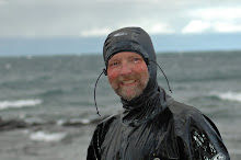
 Sunday was, unfortunately, the day the weather folk had predicted. We paddled in a steady rain but most of us had the proper gear. The light is different in the rain and it has its own unique appeal. The wildlife act a bit differently and the views are all much softer. The downside of course is that you get wet. Even the most breathable fabric, and I use 'breathable' with more than a bit of cynicism, still leaves us soaked in perspiration with even moderate exercise. Then we stop, cool down, get chilly, and have to jump back in the boats to warm up. In a wilderness area that is. In a practice wilderness like the Flowage however, there are islands of refuge where a person can get warm, dry out, and have a nourishing beverage. Herman's Landing is such a spot and they make a Bloody Mary that's hard to beat. Pickle, olive, celery, beer stick, a snit of beer, and a hard boiled egg can invigorate even the most sodden paddler and there is even a fireplace in the cozy bar room. The three mile paddle back to the cabin seemed to go by in half the time it took us to paddle over there.
 It was a great start to the paddle season. Tony from the R&R Bayview told us that things begin to calm down right after the leaf color season in September and that the Flowage is quiet once again and beautiful with the fall colors. Hunting season tends to conflict with fall paddling but I would imagine we can sneak one in at some point. Pod has suggested an annual spring weiner cook off on Weiner Island and it sounds like a good plan. So many venues, so little time. I look foward to the day when I can pursue my avocations with the same focus and energy that I now have to spend on my 'real' vocation. Every time we pack up and head home I think about the time when I can just stay an extra day or five. It can't come too soon.


1 comment:
Looks like it was a fine weekend and, like most, ended at the bar.
Post a Comment