

The theme of the presentation is pretty much weather and it's lackey, waves, in the Apostles. The undercurrent of the talk will be evaluating whether NOAA weather radio is more reliable predictor of weather than sticking your finger in your mouth and holding it up in the air to gauge wind direction. It will be tough without my co-presenter, Laurel without Hardy or Abbot without Costello, but Silbs is busily engaged in constructing a high end stitch and glue boat in his lair near Milwaukee. One of the goals of the talk will be coming up with places to paddle on the big lake when the wind and waves pretty much preclude you from making your planned route. This is the exact situation the VOR and I found ourselves in last Sunday.
 We recently acquired a place up on the peninsula and work around the house and it's nicely wild looking yard had kind of trumped kayaking for a few weeks. On Sunday I was bound and determined I'd be paddling unless the Copper Harbor fault shifted, causing an earthquake and catastrophic Lake Superior tidal waves in the Bayfield Peninsula area. OK, OK, I made that Copper Harbor fault thing up, but my attitude was I was damn well going to paddle and it was damn well going to be somewhere on the big lake.
 Of course Sunday dawned with a very plausible forecast of southwest winds building to 25-30 mph with small craft warnings going into effect at 10am that morning. For once, that is exactly how the day went down. The wind kicked up, swung to the southwest, and we had us some small craft warnings.
 The VOR, being of course the VOR, was a bit concerned about the wind. I had of course, withheld that little detail about the small craft warning. We planned to paddle into the wind for about 2/3 of the time and then spin around and cruise back to the launch site. The question then would be where to launch? It would be nice to have a lee shore, some decent scenery, and a spot where we would not have to worry about being blown to Canada, always a concern when strong southerly winds occur in the Apostles.
My 'go to' windy spot has always been Bark Bay Slough. It's not only the sight of the very first Bark Bay Fishing Invitational back in the mid 1980's, but this time of year its full of waterfowl and other wildlife. There is a very nice DNR launch that is perfect for kayaks, canoes, and small rowboats but impossible for larger powerboats. The area is dotted with bog islands and can be paddled into and down the Bark River all the way to Bark Bay, the 2nd largest bay on the south shore. Its also a go to spot for outfitters when the mainland sea cave tours get cancelled. One fine day, when a dead south wind was gusting to 40mph, I inherited the task of assisting a Trek & Trail guide in towing two doubles with rookie paddlers back to the launch after they had pretty much been pinned to the sand tombolo south of the launch, between the slough and the bay, by the wind. The effort, combine with the aggravation of seeing inexperienced paddlers launched in marginal conditions, sent me directly to the Village Inn bar in Cornucopia.

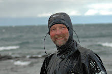
Sunday we were up for a short 90 minute paddle however, and the drive from Washburn to Cornie seemed just a bit daunting. A quick check of the map, the true wind direction, and a discussion of our visual stimulation requirements and we were off to launch and explore the shoreline illustrated in the images in this post. Where is that shoreline? It isn't the mainland caves, Bark Bay, or Sand Island, yet we did launch from the mainland. Show up Monday night at REI and maybe I'll tell you.


No comments:
Post a Comment