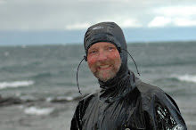
I always bring my VHF transceiver/weather radio and listen several times a day. What it usually tells me in the 'current conditions' segments is that the weather conditions 20 miles apart are completely different. The main reason for this, of course, is the lake itself and the topography of the area. The Bayfield peninsula as well as several of the island have some fairly high hills and cliffs. This time of the year the land mass is warming up nicely but the lake is not. Warm air swirling around and over the land meets the cold air above the lake and interesting things can happen. Morning fog is one of the more common ones. Don't forget your chart, compass, and/or gps. Knowing the procedure for a securite' call on the radio is a good thing to let any other boats in the area know you are making a crossing in the fog. Warm air and cold water can spawn isolated squalls also. The same winds that brings us several feet of lake effect snow in the winter can bring spring and fall storms too. These weather events happen fast. A couple Memorial Days back we were paddling east into blue skies. Shortly after I felt a cool breeze on the back of my neck the BessmerConvivialist asked, "Could one of you guys turn around and let me know if we should worry about those clouds?" I'll let you be the judge.....

And then there is the wind. One of the more interesting areas in the islands is where the highlands of Oak Island, Red Cliff Point, and Basswood Island meet. This spot is affectionately know as the Basswood Triangle. No matter which way the wind is blowing elsewhere you can be assured it ain't blowin' that way here! The wind line seems almost like an eddy line in the river. I've seen sailboats tooling along nicely and then watched the sails luff, fill up the other way, and then pop back to the original setting. This causes much scurrying amongst the boat crew as one could imagine. Back when I paddled a feathered Euro paddle, before I went over to the 'dark side' with my beloved Greenland sticks, I almost went over when a rogue gust caught my large Eurospoon blade as it was vertical over my head. Later, when the concept of the Greenland storm paddle was explained to me I understood completely.
I guess the point of this post is that the National Weather Service is great, Doppler radar is an amazing tool, and a weather radio is an essential piece of gear on a kayak trip. But keep your eyes, ears, and most importantly your instincts alert when you're in the Apostles. It will save you a lot of effort and grief.


3 comments:
Hi Dave,
thanks for the localized post on the Big Lake's weather and its quirks.
How often would you say you hear weather alerts from the CG on VHF22A?
We get them here a lot on the east coast in summer, when hot humid fronts settle in for a couple of days, then collide with cold dry fronts rolling in down off the Canadian Shield.
Adam
Adam,
I generally just listen to the NWS closest broadcast to where I am. I'm actually not familiar with any Coast Guard based weather alert on Superior. Plenty of 'warnings' on the NWS however...."Doppler radar has detected strong thunderstorm cells over Port Wing moving SE at 40 mph" type of thing.
Hi DaveO,
we get the warnings on VHF 22a, when the Coast Guard will broadcast severe thunderstorm alerts.
During overcast days in August when the sky looks especially greasy, many paddlers will keep channel 22a on scan.
Post a Comment